A realistic close-up of a modern smartphone held in a simple black armband lying on short, dew-fresh grass beside a Sydney footpath, its bright screen displaying a MapRun orienteering course with green parks, blue water, and pink control circles. Nearby, a pair of colorful running shoes are neatly placed on the pavement, their mesh texture and laces sharply defined. Early morning golden light skims across the scene, creating long, soft shadows and sparkling dew highlights. The composition is shot from a low, slightly angled perspective, with shallow depth of field that keeps the phone and shoes crisp while gently blurring the suburban houses and trees in the background. The atmosphere feels playful, motivating, and ready for adventure in a photographic, vibrant style.

What is MapRun?

Looking for a fun run in Sydney that’s different from the usual jog around the block?

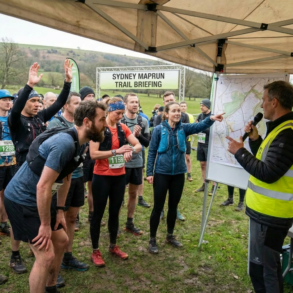
Sydney MapRun turns running into a game.

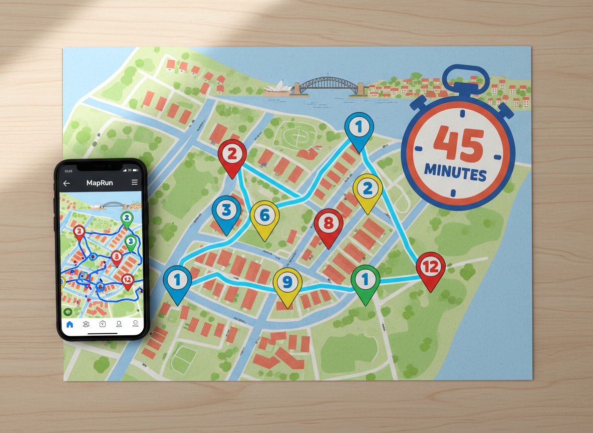
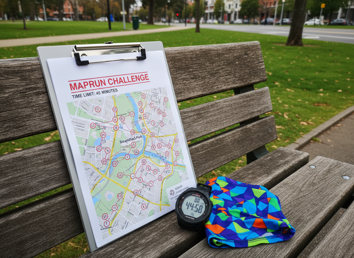
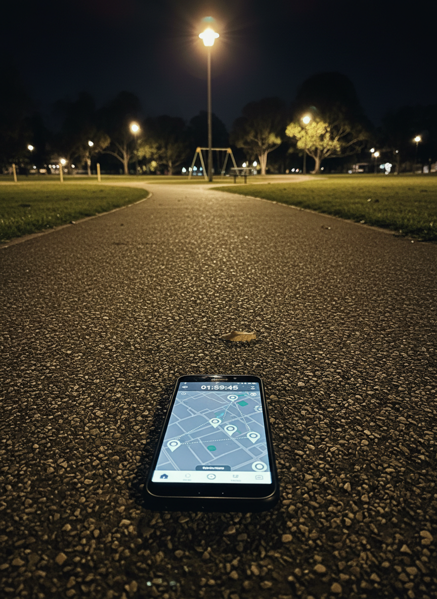
Part treasure hunt and part puzzle, Sydney MapRun events take place in a different Sydney suburb each week. Using a detailed map and the MapRun app on your phone, your challenge is simple: find as many checkpoints as you can in 45 minutes.

Up to 30 checkpoints are hidden around parks, streets and bush tracks, each with a points value. Controls 1–10 are worth 10 points, 11–20 are worth 20 points, and 21–30 are worth 30 points. The challenge isn’t just running — it’s planning the best route to collect the most points before time runs out. Be careful though — late penalties are 10 points per minute.

Do you go for the big points far away?
Can you plan the perfect route?
Can you find them all?

Along the way you’ll discover hidden corners of Sydney, explore neighbourhoods you never knew existed, and enjoy the fun of solving a navigational puzzle while running.

Sydney MapRun is for everyone — from walkers and joggers to competitive runners. If you enjoy running, exploring and the unexpected, you’ll love this unique running event series in Sydney.

What do I need?

You don’t need any special equipment to take part in Sydney MapRun.

Just bring:

  • Your normal running shoes
  • Comfortable running clothing (shorts and T-shirt are perfect)
  • A smartphone with the MapRun app installed

If it’s your first time, don’t worry — instructions and help are available at every event.

You can download the MapRun app here:

Maps for each event are available for download. Each map includes a QR code that opens the course directly in the MapRun app.

You can either:

  • Print your own map, or
  • Use the map directly in the app

Before you start, take a few minutes to study the map and plan your best route — good planning can make a big difference!

A dynamic photographic scene of a winding Sydney harbourside path captured from a slightly elevated angle, with glimmering blue water, rocky foreshore, and city skyline in the distant haze. Overlaid on the path and surrounding streets is a translucent orienteering course: numbered circles, connecting lines, and softly glowing checkpoints tucked into corners, park entrances, and stairs. Late afternoon golden-hour sunlight washes the scene with warm tones, creating long shadows from railings and trees and sparkling highlights on the water. The composition uses the rule of thirds to balance the coastline and map overlay, with sharp focus throughout. The mood is adventurous and playful, as if the familiar harbour walk has transformed into an interactive urban playground, captured in crisp photographic realism.
A night-time photographic view of a quiet Sydney suburban park, the grass a deep, rich green under evenly spaced warm lampposts. On a central gravel path, a modern smartphone rests on the ground, its bright screen glowing with a live MapRun course, complete with pulsing checkpoint icons and a ticking countdown timer. Faint digital lines extend from the screen into the darkness, suggesting hidden checkpoints among trees, playground equipment, and pathway junctions. The lighting contrast between the warm lamplight and cool phone glow creates dramatic, playful shadows and highlights. Captured from a low, cinematic angle with shallow depth of field, the phone is in razor-sharp focus while the background is softly blurred with subtle bokeh from distant lights, evoking a sense of secret night-time adventure.

How MapRun Works

Open the event in MapRun
Scan the QR code on the map, or find the event in the app:

Select Event → NSW → Sydney → MapRun

Load the map
When prompted, tap OK to load the map. It may take a few seconds.

View the course
Tap Go to Start to see the map and checkpoints.
For most events you will need to enter a 4-digit PIN, which is printed on your map.

Start your run
Once you start, the app will show your location on the map – until you reach the Start control. Run or walk through the Start to trigger the timer.

Collect checkpoints
You have 45 minutes to visit as many checkpoints as possible.

Score points

  • Checkpoints 1–10 = 10 points each
  • Checkpoints 11–20 = 20 points each
  • Checkpoints 21–30 = 30 points each

Finish
Return to the Finish (same location as the Start) before time runs out.
Late penalties are 10 points per minute, or part thereof.

Upload your result
Your result uploads automatically when you finish. You can also send your run to Strava.

Compare routes
After the event you can compare your route and score with other participants.

About

How does MapRun work?

Sydney MapRun is a weekly social orienteering event using the MapRun app to turn Sydney suburbs into a 45‑minute score course, where you find virtual checkpoints, earn points, and explore new neighbourhoods at your own pace.

Runners listen to a Ridgewood Trail Run 2024 pre-race briefing while reviewing a course map.
Runners gather under a tent for a course briefing before the Ridgewood Trail Run 2024.
A detailed overhead photographic view of a colorful suburban Sydney street map printed on slightly textured matte paper, spread across a light wooden table. Brightly colored circular checkpoints and a bold, playful 45-minute timer icon are overlaid on the map, with a modern smartphone resting beside it showing the MapRun app screen and a glowing GPS route snaking between checkpoints. Soft natural daylight from a nearby window casts gentle, realistic shadows and subtle highlights across the scene. The mood is energetic and inviting, suggesting a fun challenge. Shot with sharp focus throughout, using a clean, modern composition that emphasizes the map, route, and app screen, in vibrant photographic realism aligned with a playful, game-like aesthetic.
A detailed photographic close-up of a printed MapRun event sheet clipped to a small metal clipboard resting on a park bench made of weathered wooden slats. The sheet shows a Sydney suburb map with clearly marked checkpoints, scoring values, and a bold 45-minute time limit graphic. Beside it lies a lightweight digital sports watch with the screen set to a countdown timer, and a folded, brightly colored trail buff with a playful pattern. Soft overcast daylight creates diffused, shadowless lighting that reveals textures in the wood, paper, and fabric. Captured from a slightly elevated angle with moderate depth of field, the background of blurred green lawns and urban park pathways sets a relaxed, anticipatory mood, emphasizing organized fun and casual competition in realistic, vibrant detail.
A wide photographic view of a quiet Sydney suburban intersection at dusk, with leafy trees, parked cars, and a mix of sandstone cottages and modern terraces. Floating above the footpaths and street corners are semi-transparent, glowing digital checkpoint markers and a dotted GPS route line, seamlessly blended into the real environment. The sky glows soft pink and blue, with warm streetlights just starting to glow, casting gentle reflections on the asphalt. The mood is playful and slightly futuristic, as if the suburb has become a game board. Captured at eye level with a wide lens, sharp focus, and balanced composition, the image feels realistic yet gamified, with vibrant colors and a clean, modern photographic aesthetic.